|
#SPARCC17
I got in to SPARCC17 (Stark/Portage Area Computer Consortium) at the last minute (apparently some people had to cancel, thank you). It is held at Stark State College (where I taught for 5 years a LONG time ago). This was year 13 and still free, thanks to a good base of sponsors. Eric Curts is the main organizer (follow him and his website). They have a good mix of topics/presenters and 15 minutes between sessions. I started with an Adobe Spark session to refresh my memory about this tool. Students making book trailers was the core of this. I had mentioned this idea to my librarian for several years, but they never went anywhere with it. The new thing I found was http://booknook.infohio.org/ where teachers can submit student book reviews and they are accessible to all. That site/service might even link the book review in your library catalog?? I don't know why ALL schools don’t do this. I found out about https://meet.libbyapp.com/ which is an app to read library books, need to investigate further. Also found that there is a mobile maker space in SW Ohio called TinkerTank. I need to go visit them. The final session I went to was about Google Maps, Streetview, and Cardboard. Just wanted to see what they knew. Again, why don’t all schools have tours of their buildings available on Maps/Streetview??? Got to catch up with a couple of people in my network (Melissa & Andreas), but only added a couple of people to my network.
0 Comments
Summer is when I take time to build stuff (in addition to home improvements like new stairs and siding). Some of the things I have built so far are flower boxes, bookshelves, trellis, another workbench (for my new CNC router machine), portable whiteboard... I want to also make videos about how I built them. Just to share. My next big thing is learning how to use the CNC router. I will need this skill for any MakerSpace or FabLab that I want to set up or work in. I probably will be playing more with some electronics/programming, hummingbird kits or edison or circuit playground … Maybe I should take requests...what do you want me to build/learn and teach you with a video? A couple of videos I did recently... 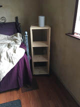 3 shelf rack (https://www.youtube.com/watch?v=K9h0i1VEty4 ) I built this from ¾” strips of wood long enough to get 12”x12”x12” spaces. It cost less than $20 and works nicely as a night stand holding up a lamp. 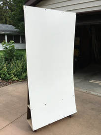 Portable whiteboard (https://www.youtube.com/watch?v=id3kPWerNZM ) I saw several versions of simple whiteboards on wheels that can also act as dividers and wanted to try to build one. This cost about $70 to build ($25 for boards and $25 for casters). I was aiming for one with a shelf on the bottom. It works fine and i will use it often in my shop. The biggest flaw is it is a little wobbly because the boards are kind of free floating vertically, just some pressure from the other holding it up. There are other ideas on how to build this more stable, but I have newer things to spend money on. 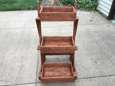 3 box planter (https://www.youtube.com/watch?v=zz-MbHXvmXo ) 8 - 1”x4” furring strips (not #1 pine, just for cost) The wood costs about $17, then some miscellaneous shop materials (glue, nails/screws, stain). Made a little mistake with the top shelf….it should not be end to end (some of it should stick out past the supports). This makes the uprights “fade out” a little (not be perfectly vertical. Since this will be an “extended summer” (sabbatical) the building will continue. Just wait til I learn how to use a CNC router…..Homemade Christmas presents!!! (some other things i have built….but no videos
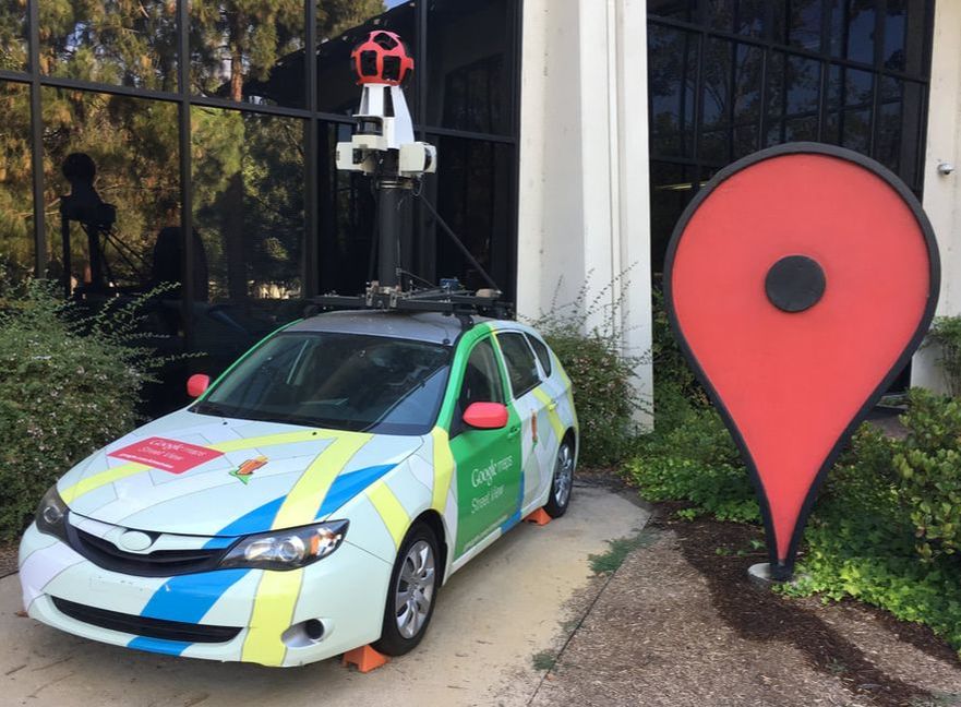 Has it really been 3 weeks since Google Geo Teachers Institute? I should have written something long ago...I’m working on that. I got the opportunity to attend the 2017 California Google Geo Teachers Institute (#CAGTI17 ) in Mountain View, to learn about the Google Geo tools and their fit in education. And they fit pretty much everywhere in learning. As someone said “All the world’s most pressing problems have a geospatial component to them” (I think it was Emily Henderson) Some of the tools and ideas we discussed were Google Earth itself, MyMaps, TourBuilder, Streetview, 360 cameras, Expeditions and Cardboard. There were so many sessions and so much information shared, yes info overload. After #CAGTI17 there was a mad hunt at airports for half priced 360 cameras. Other people do a much better job of telling you about the tools, so I will not do that here. You should check out the hash tag for links, or start with Shake Up Learning to get some good details). Good google twitters to follow would be @earthoutreach & @googleearth. It all started before arriving in Mountain View. A google hangout was created to start getting to know each other and arrange meetups or shared transportation. I met Carla on the airplane from Minneapolis to San Francisco (i think twitter is randomly deleting people I follow because I cannot find her in my “following”). Natahsa ran into us at SFO (randomly walking down the hall to car rental, though she was looking for me). The three of us (Carla had a rental car, thank you Carla) met up with a bunch others at Eureka burger place before heading to hotels/AirBnB for a good nights sleep. John Bailey was our Google Host and Leader. The dozen “blue shirts” were an awesome bunch of educators who are Google gurus and lead us through our learning (@ellenecurtis , @techfairies2 , @BWhitlowEdTech , @mrpiercEy , @DesignSaunders , @scubagirl812 @DeanPhillipsMT and @crewsertech to mention a few ). They created a fun atmosphere with themed tables (we were assigned a team to begin the days), decorations on the tables, kahoot games with prizes, and voting for best table decorations. I finally met Jaime ( @JChanter22) who lives 45 minutes away in Ohio, and Rola ( @rolat ) who knows Shauna (@misspollock ) in Ottawa. Of course I met more people. There were about 100 educators from around the world and hope we continue discussions via hangout or twitter. It was great to meet, work with, and especially hang out and talk with these people Big tool takeaways…. Every student should be working/creating with these geo tools , especially Tourbuilder, My Maps, Streetview and Google Earth, at various points in their life. Cardboard and Expeditions have some great possibilities. Every school should have tours of their campuses and buildings put into streetview and My Maps and linked from their websites. We only have one “pale blue dot” and we need to take better care of it, and that starts with understanding it. 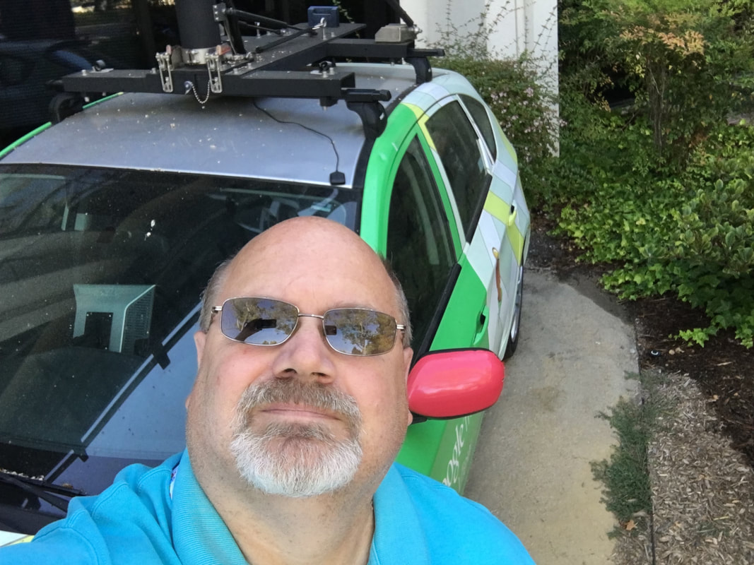 |
Archives
December 2022
Categories |
 RSS Feed